Path of Destruction
Afternoon of Tuesday, May 13, 1980
1:30 | Tornado watch issued in Southwest Michigan
2:30 | Funnel cloud spotted in Van Buren County
2:35 | Reports of funnel cloud spotted near Bangor, Van Buren County
3:48 | Tornado damage reported 14 miles west of Kalamazoo near Glendale, Van Buren County
4:00 | Tornado warning issued and sirens sound for city of Kalamazoo and surrounding areas
4:09 | Tornado enters western part of city and township limits, moving eastward
4:09-4:12 | Tornado strikes neighborhoods near the edge of Kalamazoo Township and City lines, skips and slams through Mountain Home Cemetery – Mari Gilman is killed at the Norge Laundry and Dry Cleaning on West Main St.
4:13-4:19 | Tornado lands in downtown Kalamazoo – three people are killed; Francis Hardy while traveling down Rose St. near Bronson Park, and Christina Wellington and Lucia McFall on Farmer’s Alley behind the Gilmore Department Store.
4:20-4:24 | Tornado crosses Pitcher St. traveling towards Comstock Township, damaging several industrial plants – Raymond Moyer is killed on Wynn Rd. in Comstock Township.
4:25 | Tornado dissipates between King Hwy and Comstock Ave., in central Kalamazoo County, just northwest of the village of Comstock

Looking north on Rose St. from the South St. intersection., the Young Women’s Christian Association (now Greenleaf Trust) and Industrial State Bank (now Comerica) buildings are visible on right. The skywalk connecting a parking garage and the Kalamazoo Center Hilton Inn (now Raddison Plaza Hotel) is also visible. (KVM 80.752)

F3 on the Fjuita Scale
In June 1980, Dr. Tetsuya Theodore Fujita of the University of Chicago visited Kalamazoo to survey the damage left by the tornado. Dr. Fujita, in collaboration with Allen Pearson, head of the National Severe Storms Forecast Center, released a scale in 1971 to measure the intensity and severity of tornadoes called the Fujita Scale. While in Kalamazoo, Dr. Fujita confirmed a rating of F3, based on counterclockwise wind speeds reaching upwards of 150 – 175 miles per hour.

Video still from the documentary, MR. TORNADO, on PBS’ American Experience
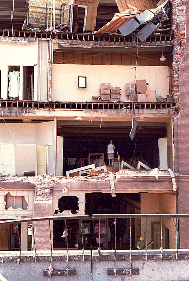
Scenes of Devastation
This gallery represents a broad look at the havoc that occurred on May 13, 1980. From wiped out homes and businesses to the tragic loss of lives, these photos remind us of the destructive force of nature and fragility of everyday life.